4,3 km | 5,8 km-effort
Le Moulin du Boeuf
SityTrail - itinéraires balisés pédestres
Tous les sentiers balisés d’Europe GUIDE+
Lengte
6,1 km
Max. hoogte
232 m
Positief hoogteverschil
133 m
Km-Effort
7,9 km
Min. hoogte
145 m
Negatief hoogteverschil
130 m
Boucle
Ja
Markering
Datum van aanmaak :
2022-02-15 14:53:15.138
Laatste wijziging :
2022-03-02 17:00:35.243
1h47
Moeilijkheid : Gemakkelijk
Gratisgps-wandelapplicatie
Over ons
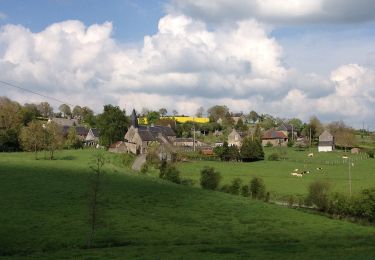
Tocht Te voet van 6,1 km beschikbaar op Normandië, Calvados, Terres de Druance. Deze tocht wordt voorgesteld door SityTrail - itinéraires balisés pédestres.
Plaatsbepaling
Land:
France
Regio :
Normandië
Departement/Provincie :
Calvados
Gemeente :
Terres de Druance
Locatie:
Saint-Vigor-des-Mézerets
Vertrek:(Dec)
Vertrek:(UTM)
673550 ; 5419220 (30U) N.
Opmerkingen
Wandeltochten in de omgeving
La Chapelle Engerbold
Te voet
Gemakkelijk
Condé-en-Normandie,
Normandië,
Calvados,
France
1h 18min
Ja
Tour du Bourg
Te voet
Gemakkelijk
Terres de Druance,
Normandië,
Calvados,
France
3,3 km | 4,2 km-effort
57min
Ja
A la Découverte des "Fées Baligot"
Te voet
Gemakkelijk
Condé-en-Normandie,
Normandië,
Calvados,
France
10,4 km | 13,6 km-effort
3h 5min
Ja
Chemins Creux E
Te voet
Gemakkelijk
Condé-en-Normandie,
Normandië,
Calvados,
France
6,6 km | 8,2 km-effort
1h 51min
Ja
Chemins Creux C
Te voet
Gemakkelijk
Périgny,
Normandië,
Calvados,
France
4,2 km | 5,1 km-effort
1h 10min
Ja
Chemins Creux A
Te voet
Gemakkelijk
Pontécoulant,
Normandië,
Calvados,
France
3,8 km | 5,7 km-effort
1h 17min
Ja
Chemins Creux D
Te voet
Gemakkelijk
Condé-en-Normandie,
Normandië,
Calvados,
France
6,9 km | 8,6 km-effort
1h 56min
Ja
Autour d'un Château
Te voet
Gemakkelijk
Condé-en-Normandie,
Normandië,
Calvados,
France
9 km | 12,2 km-effort
2h 46min
Ja
Le Ruisseau des Vaux
Te voet
Gemakkelijk
Terres de Druance,
Normandië,
Calvados,
France
10,4 km | 13,4 km-effort
3h 2min
Ja